- Slug: BC-CNS Severe Weather, 375 words.
- 1 photo and caption below.
By Jordan Evans
Cronkite News
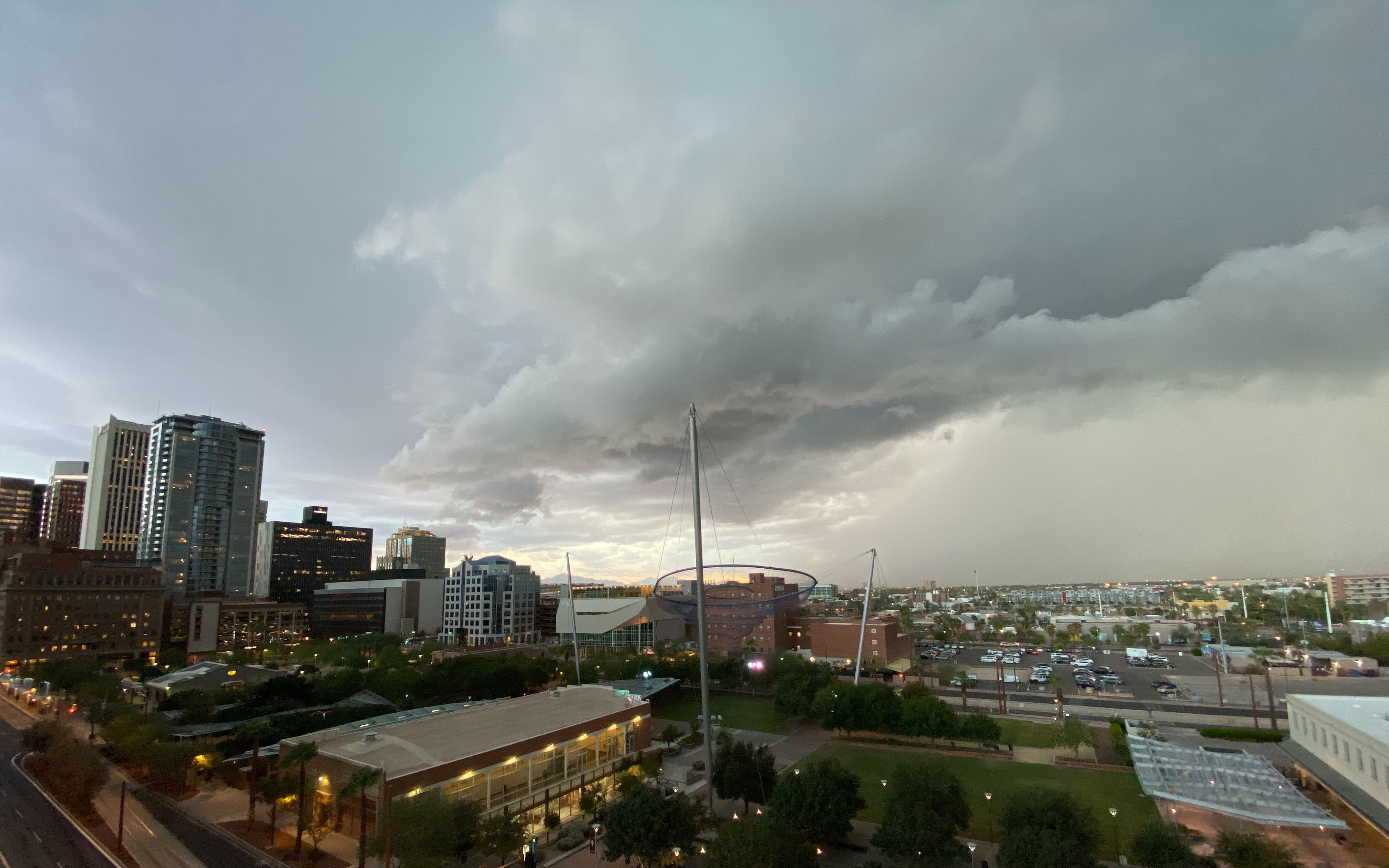
PHOENIX – A powerful storm system brought flooding and power outages to parts of metro Phoenix on Monday evening, and more severe weather could be on the way this week.
Yuma County has the best possibility for showers and storms today, with occasional showers possible in Maricopa County.
Coming on the heels of early morning storms that pounded the East Valley, severe thunderstorms moved over Phoenix during the evening rush hour Monday. The National Weather Service reported penny- to nickel-size hail north of downtown Phoenix and in Paradise Valley.
A severe thunderstorm over Cave Creek on Monday afternoon prompted the weather service to issue a tornado warning for the area. It was the Phoenix office’s first tornado warning in five years.
Videos of the possible twister have surfaced on social media, but as of Tuesday morning, the National Weather Service had not confirmed it was a tornado.
People also posted photos of walls of dust south of Phoenix. Visibility was reduced to less than a quarter of a mile along Interstate 10 from Casa Grande to Tucson.
Storms dropped more than 2 inches of rain in parts of Mesa and 3 inches in Apache Junction. Record amounts of rain fell in Scottsdale, north Phoenix and Surprise.
Mesa Fire & Medical rescued several stranded drivers in their vehicles, and the National Weather Service reported street flooding in parts of Mesa, Apache Junction and Fountain Hills.
Ahead of Monday’s storm system, ample moisture from the remnants of tropical storms Lorena and Mario, which dissipated last weekend, has fueled the atmosphere.
The atmospheric setup Monday was similar to two previous severe weather events over Arizona. In late September 2014, an intense line of thunderstorms moved through the Valley and central Arizona bringing high wind gusts near 70 mph that damaged some of the terminals at Phoenix Sky Harbor International Airport.
In early October 2010, Phoenix saw its largest hailstone ever, at 3 inches in diameter – nearly the size of a baseball. This was a rare event for Phoenix, as hail this big primarily occurs over the Great Plains. The same storm system spawned multiple tornadoes in the high country, including one that damaged homes in Bellemont.
Sign up for CRONKITE DAILY to catch up on the latest news.
^_=